
Geospatial Collaboration
Without Limits
Revolutionize How You Visualize, Analyze, and Share Geospatial Data
SOLV3D Cloud is the best platform to share and collaborate your Digital Twin data.
Collaborative Precision for 3D Geospatial Workflows
SOLV3D Cloud is a cloud-based application designed to simplify the visualization, analysis, and sharing of all your geospatial project data no matter the size or complexity. SOLV3D enables your entire team to visualize, interact, and act on your digital twin data with all of your data.


Empower Your Team with 3D Data
From 3D point clouds to imagery, unlock insights with easy to use 3D collaboration.
Import
-
Easily import your 3D point clouds, imagery, CAD drawings, and models
-
Integrate into a single interactive virtual 3D environment.
Access
-
Easily collaborate with your entire organization or project
-
Avoid costly site visits by viewing your projects from anywhere in the world
Interact
-
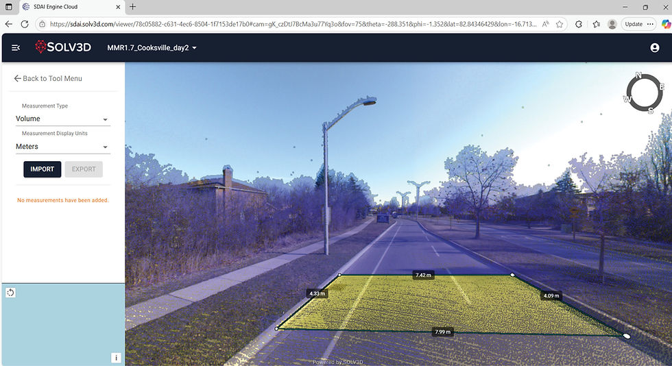
Accurately tag, mark, measure, analyze and explore your project
-
Identify risks, create plans, reduce costs and accelerate your project

Transform Data into Information
SOLV3D Cloud integrates cutting-edge technologies that combines data sets from images, points clouds, GIS, and engineering models. Our unique virtual and augmented reality (VR, AR) allows you to seamlessly and easily explore and analyze information in an easy to use immersive and interactive environment.
Seamless Collaboration and Decision-Making
SOLV3D Cloud enables powerful real-time collaboration including virtual walkthroughs from the comfort of the office. It enhances teamwork by allowing stakeholders to share insights from the desk to the field ensuring everyone stays aligned. By empowering you to monitor, manage, and optimize critical infrastructure, SOLV3D Cloud delivers the most accurate and up-to-date data for tracking asset health, measuring compliance, and mitigating risks.


-
Access imagery, point clouds, drawings, and attributes in one place
-
Coordinate resources and collaborate projects
-
Virtual walkthroughs
-
Pre and post project inspections
-
2D and 3D measurements
-
Visualize and qualify risks
-
Search for assets and areas of concern
-
Fast, 24-7 access
-
Unlimited user accounts
-
Cost is relative to the volume of data you publish
Features & Benefits

